- Start
- Curative and Healing Forest
- Map and graduation of trails
The maps of the Healing Forest
You will also find the maps in the Healing Forest – and of course your actual location is also indicated to help you find your way around. So it’s no problem if you leave your Smartphone behind .... In addition to the Healing Forest with the trail network, you will find another map with the paths graduated according to difficulty so that you can estimate whether you easily complete your intended route or if it would be too difficult.
General map with trail network
The Heringsdorf Healing Forest follows a ridge above the town, parallel to the coast. From the top of the Präsidentenberg, at the site of the former Bismarckwarte (Bismarck Tower) you can enjoy a wonderful view of the Baltic.
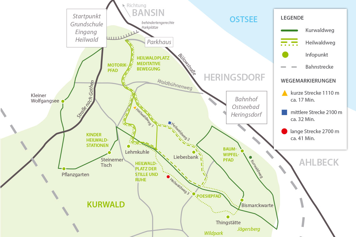
The sculpture carved from gneiss by sculptor Jörg Steinert shows you the four cardinal points – an additional pointer and a joy for the senses.
Map with trail graduations
Another map of the path network, this time with difficulty graduations. The terrain underlying the forest offers everything – from easy paths to more challenging trails that are not suitable for everyone. If you do not have serious health limitations, you will manage the entire route without any difficulty. If in doubt, it’s a good idea to first talk to your doctor.
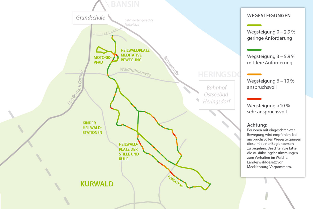
Demanding path gradients: from 6% to over 10%
Note: Persons with limited mobility are recommended to only attempt the demanding trails with the support of an accompanying person. Note the code of conduct for forests in accordance with the State of Mecklenburg-Vorpommern Forest Law.